pilotwx

Fetched . Reload for newer reports. Full weather map · Map PNG · Text · JSON

Full map PNG
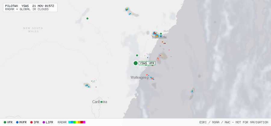
Live aviation weather map for YSWS with radar, infrared cloud cover, advisories, and station flight categories
VFR MVFR IFR LIFR SIGMET G-AIRMET PIREP Fetched 19 Nov 2245Z

YSWS

Western Sydney Intl, NSW, AU

VFR

METAR

METAR observed , 15 min ago

METAR YSWS 192230Z AUTO 19007KT 9999 // SCT022 23/17 Q1019
Wind
190° at 7 kt
Visibility
6+ SM
Clouds
SCT 2,200 ft
Ceiling
none
Temperature
23°C, dewpoint 17°C
Altimeter
30.09 inHg (1019 hPa)

TAF

Issued , valid 19 Nov 1800Z to 20 Nov 1800Z

TAF YSWS 191713Z 1918/2018 24005KT CAVOK
  FM192200 VRB03KT 9999 FEW030
  FM200000 03008KT 9999 -SHRA NSC
  FM200400 04014KT 9999 -SHRA NSC
  FM200800 02006KT 9999 -SHRA NSC INTER 2003/2018 4000 SHRA FEW070TCU

Advisories & PIREPs

Within 70 NM · 1 active item

SIGMETs (1)

  • ICE YMMM K10 · ICE · SEV · 10,000 ft to FL230 Valid 19 Nov 2000Z to 20 Nov 0000Z
    WSAU21 YMMC 191949
    YMMM SIGMET K10 VALID 192000/200000 YMMC-
    YMMM MELBOURNE FIR SEV ICE FCST WI S4453 E13727 - S4410 E14100 -
    S4020 E14510 - S3320 E14740 - S3426 E14951 - S3620 E15130 - S4048
    E14932 - S4440 E14520 - S4711 E13841 10000FT/FL230 MOV SSE 20KT NC=

G-AIRMETs (0)

No active CONUS G-AIRMETs (+0h) within 70 NM.

PIREPs — last 3 h (0)

No PIREPs reported within 70 NM in the last 3 hours.