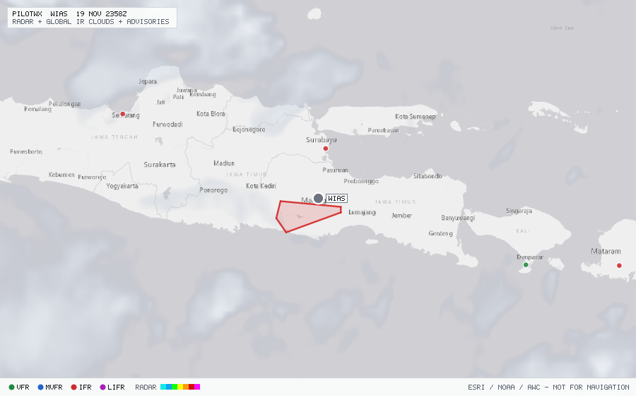
WIAS
Malang
The station exists but has no recent METAR or TAF.

Malang
The station exists but has no recent METAR or TAF.
Within 70 NM · 1 active item
WVID21 WAAA 191630
WAAF SIGMET 27 VALID 191630/192230 WAAA- WAAF UJUNG PANDANG FIR VA
ERUPTION MT SEMERU PSN S0806 E11255 VA CLD OBS AT 1600Z WI S0804
E11258 - S0808 E11258 - S0822 E11219 - S0812 E11212 - S0800 E11215 -
S0804 E11258 SFC/FL150 MOV W 05KT NC=
No active CONUS G-AIRMETs (+0h) within 70 NM.
No PIREPs reported within 70 NM in the last 3 hours.