pilotwx

Fetched . Reload for newer reports. Full weather map · Map PNG · Text · JSON

Full map PNG
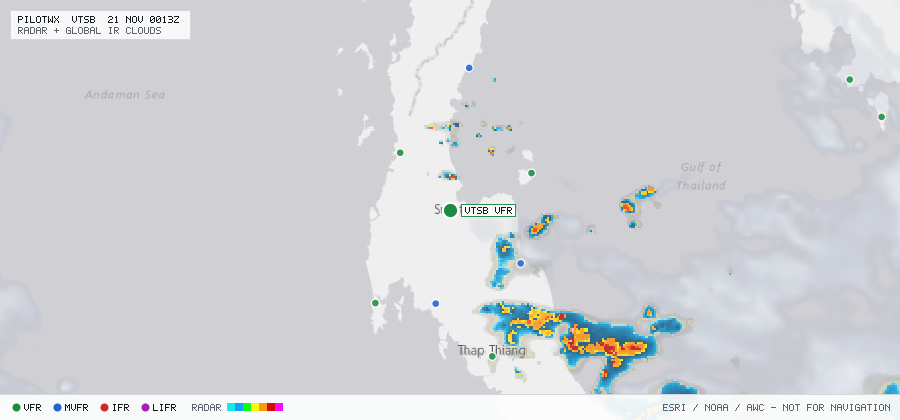
Live aviation weather map for VTSB with radar, infrared cloud cover, advisories, and station flight categories
VFR MVFR IFR LIFR SIGMET G-AIRMET PIREP Fetched 20 Nov 2344Z

VTSB

Surat Thani Intl, 84, TH

MVFR

METAR

METAR observed , 45 min ago

METAR VTSB 202300Z 36001KT 8000 FEW020 25/25 Q1012 NOSIG
Wind
360° at 1 kt
Visibility
4.97 SM
Clouds
FEW 2,000 ft
Ceiling
none
Temperature
25°C, dewpoint 25°C
Altimeter
29.88 inHg (1012 hPa)

TAF

Issued , valid 21 Nov 0000Z to 22 Nov 0000Z

TAF VTSB 202300Z 2100/2124 33005KT 9000 FEW020
  BECMG 2103/2105 05008KT
  TEMPO 2106/2112 VRB15G25KT -TSRA FEW016CB SCT018 BKN100
  BECMG 2113/2115 33003KT

Advisories & PIREPs

Within 70 NM · 0 active items

SIGMETs (0)

No active SIGMETs within 70 NM.

G-AIRMETs (0)

No active CONUS G-AIRMETs (+0h) within 70 NM.

PIREPs — last 3 h (0)

No PIREPs reported within 70 NM in the last 3 hours.