pilotwx

Fetched . Reload for newer reports. Full weather map · Map PNG · Text · JSON

Full map PNG
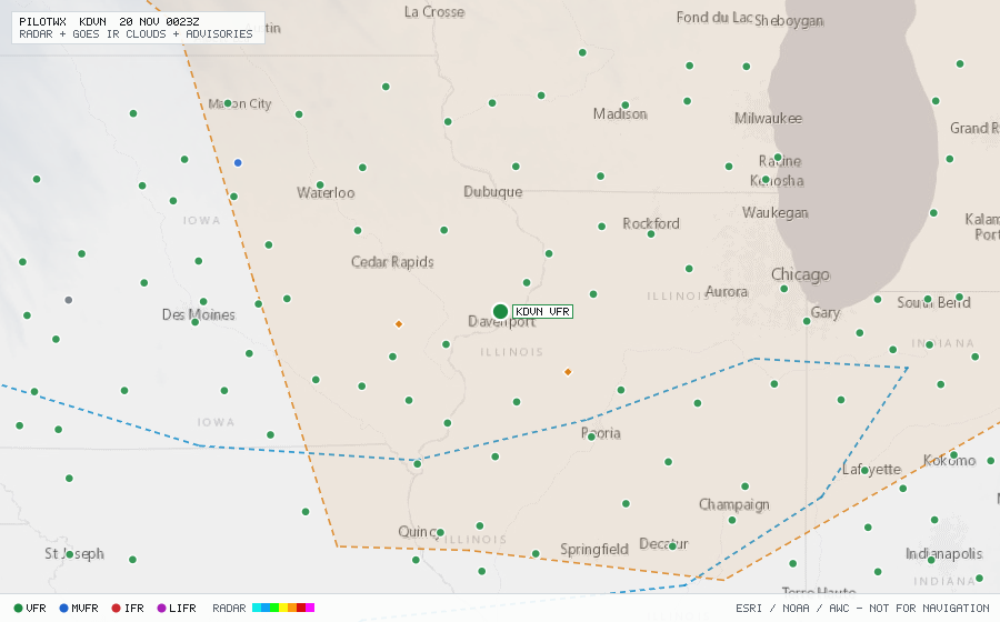
Live aviation weather map for KDVN with radar, infrared cloud cover, advisories, and station flight categories
VFR MVFR IFR LIFR SIGMET G-AIRMET PIREP Fetched 20 Nov 0011Z

KDVN

Davenport Muni, IA, US

VFR

METAR

METAR observed , 20 min ago

METAR KDVN 192352Z AUTO 20008KT 10SM CLR 15/07 A3026 RMK AO2 SLP244 T01500067 10194 20150 52007
Wind
200° at 8 kt
Visibility
10+ SM
Clouds
clear below 12,000 ft (CLR)
Ceiling
none
Temperature
15°C, dewpoint 6.7°C
Altimeter
30.26 inHg (1025 hPa)

TAF

No TAF issued for this station.

Advisories & PIREPs

Within 70 NM · 4 active items

SIGMETs (0)

No active SIGMETs within 70 NM.

G-AIRMETs (2)

  • FZLVL ZULU — 12,000 ft (Expires 20 Nov 0300Z)
  • TURB-HI TANGO — MOD · FL220 to FL360 (Expires 20 Nov 0300Z)

PIREPs — last 3 h (2)

  • B738 · FL350 · 41 NM · 19 Nov 2344Z (28 min ago)
    C75 UA /OV BDF270015/TM 2344/FL350/TP B738/TB CONS LGT CHOPOCNL MOD CHOP
  • A321 · FL320 · 46 NM · 19 Nov 2321Z (51 min ago)
    IOW UA /OV IOW/TM 2321/FL320/TP A321/TB NEG