pilotwx

Fetched . Reload for newer reports. Full weather map · Map PNG · Text · JSON

Full map PNG
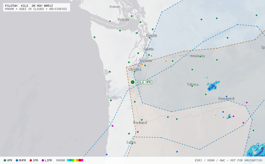
Live aviation weather map for KCLS with radar, infrared cloud cover, advisories, and station flight categories
VFR MVFR IFR LIFR SIGMET G-AIRMET PIREP Fetched 19 Nov 2247Z

KCLS

Chehalis-Centralia Arpt, WA, US

VFR

METAR

METAR observed , 13 min ago

METAR KCLS 192235Z AUTO 00000KT 10SM CLR 08/08 A2994 RMK AO2
Wind
calm
Visibility
10+ SM
Clouds
clear below 12,000 ft (CLR)
Ceiling
none
Temperature
8°C, dewpoint 8°C
Altimeter
29.94 inHg (1014 hPa)

TAF

No TAF issued for this station.

Advisories & PIREPs

Within 70 NM · 7 active items

SIGMETs (0)

No active SIGMETs within 70 NM.

G-AIRMETs (4)

  • ICE ZULU — MOD · FZL to 16,000 ft · due to ICE (Expires 20 Nov 0300Z)
  • IFR SIERRA — due to CIG BLW 010 VIS BLW 3SM BR FG (Expires 20 Nov 0300Z)
  • MT_OBSC SIERRA — due to MTNS OBSC BY CLDS PCPN BR (Expires 20 Nov 0300Z)
  • FZLVL ZULU — 4,000 ft (Expires 20 Nov 0300Z)

PIREPs — last 3 h (3)

  • C68A · 2,000 ft · 55 NM · 19 Nov 2214Z (34 min ago)
    000 UBUS31 KWBC 190120 PRCUS BFI UA /OV BFI135008/TM 2214/FL020/TP C68A/RM SMOOTH RIDE
  • E75L · 17,000 ft · 67 NM · 19 Nov 2207Z (41 min ago)
    SEA UA /OV SEA090030/TM 2207/FL170/TP E75L/IC NEG/RM DURC ZSE
  • B739 · 0 ft · 67 NM · 19 Nov 2109Z (1 h 39 min ago)
    PDX UA /OV KPDX/TM 2109/FLDURD/TP B739/SK OVC004-TOP008