
FDNH
Nhlangano Arpt
The station exists but has no recent METAR or TAF.
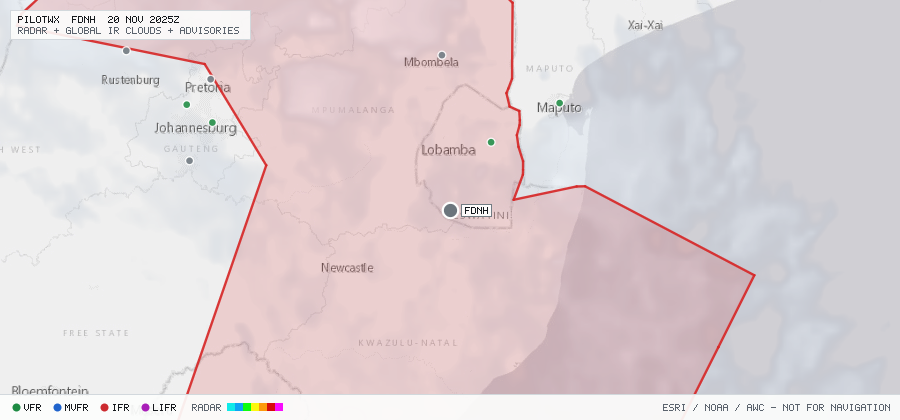
Nhlangano Arpt
The station exists but has no recent METAR or TAF.
Within 70 NM · 1 active item
WSZA21 FAOR 201834
FAJA SIGMET B01 VALID 201800/202200 FAOR-
FAJA JOHANNESBURG FIR EMBD TS OBS WI
S2238 E02814 - S2332 E03034 - S2450 E03202 - S2502 E03203 -
S2528 E03200 - S2536 E03200 - S2548 E03155 - S2557 E03158 -
S2600 E03205 - S2619 E03204 - S2630 E03207 - S2643 E03207 -
S2700 E03200 - S2650 E03253 - S2750 E03500 - S3025 E03332 -
S3300 E03200 - S3046 E02801 - S3051 E02715 - S2637 E02855 -
S2529 E02809 - S2503 E02548 - S2455 E02552 - S2440 E02610 -
S2438 E02623 - S2418 E02650 - S2338 E02700 - S2324 E02732 -
S2300 E02800 - S2250 E02802 TOP FL400=
No active CONUS G-AIRMETs (+0h) within 70 NM.
No PIREPs reported within 70 NM in the last 3 hours.